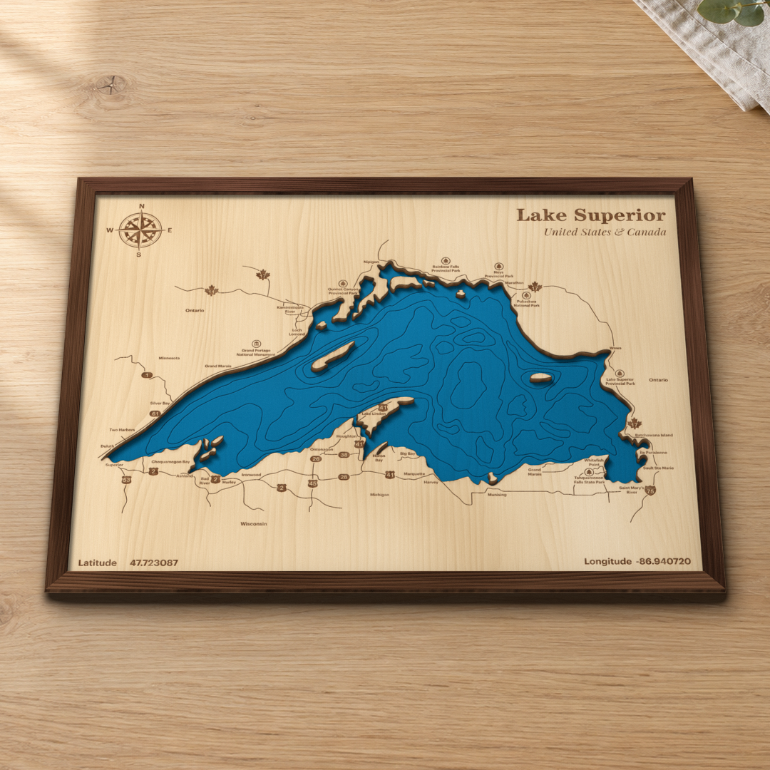


Lake Superior Wood Map
Lake Superior Wood Map
Share The Love
Couldn't load pickup availability
Layered 3D Lake Superior art · Handmade in Newark, NY
- 🌊 Layered maple land over hand-painted blue water, with depth contours scored in
- 🪵 Framed in 1/2" stained walnut, ready to hang. Painted black frame also available.
- 📏 16.4 × 12.4 in framed
🚚 Ships in 1–2 business days.
Lake Superior, United States & Canada, cut in real wood
Lake Superior is the largest of the Great Lakes, shared by Minnesota, Wisconsin, Michigan and Ontario. This map takes in the whole lake, from Duluth and the North Shore around Thunder Bay, Wawa and Sault Ste Marie to the Keweenaw and Chequamegon Bay. If you've driven the North Shore, camped in the Upper Peninsula or watched the freighters come into Duluth, this is your lake.
How we make it
The land is layered maple, laser-cut along the shoreline and engraved with the roads and landmarks. Underneath, the water is hand-painted blue with the depth contours scored in, so the shoreline casts a real shadow. Then we frame it in 1/2" stained walnut. Every map is cut, painted and assembled by hand in our Newark, NY shop.
What's on your map
Duluth · Superior · Two Harbors · Silver Bay · Grand Marais (MN) · Grand Portage National Monument · Loch Lomond · Kaministiquia River · Ouimet Canyon Provincial Park · Nipigon · Rainbow Falls Provincial Park · Neys Provincial Park · Marathon · Pukaskwa National Park · Wawa · Lake Superior Provincial Park · Batchawana Island · Ile Parisienne · Sault Ste Marie · Saint Mary's River · Whitefish Point · Tahquamenon Falls State Park · Grand Marais (MI) · Munising · Marquette · Harvey · Big Bay · Huron Bay · Houghton · Lake Linden · Ontonagon · Ironwood · Hurley · Bad River · Ashland · Chequamegon Bay · Minnesota · Wisconsin · Michigan · Ontario · US 2, 41 and 45, I-75, Hwys 17, 11, 61, 53 · compass rose · title 'Lake Superior / United States & Canada' · latitude 47.723087 / longitude -86.940720
Specs
- Size: 16.4 × 12.4 in framed
- Materials: laser-cut and engraved maple land layer, hand-painted water layer
- Frame: 1/2" stained walnut (default) or painted black, same price
- Hanging: hanging hardware included, ready to hang
- Ships: leaves our Newark, NY shop in 1–2 business days
- Made in: Newark, NY
The gift for the person who has everything
Housewarmings, retirements, birthdays and lake-house closings. Perfect for anyone who grew up on the North Shore, has a camp in the U.P., or calls Duluth, Marquette or Thunder Bay home.
FAQ
How big is it? 16.4 × 12.4 in framed.
Walnut or black? Walnut is warm and rustic. Black is crisp and modern. Same map, same price.
How long does it take? It leaves our Newark, NY shop in 1–2 business days.
Can you add our house or a name? This map is sold as shown. Want your own place mapped? We make a custom wood map of any place, and it ships 3–5 business days after you approve your proof.
More Great Lakes maps: The Great Lakes · Lake Erie · Lake Ontario